Fond de plan OSM/Géo2France
Fond de plan basé sur les données OSM et stylisé par Géo2France et Picardie Nature. Ce fond de plan existe en 6 déclinaisons :
- Couleurs vives
- Couleurs en demi-teintes
- Niveaux de gris
- Sans toponymes
- Avec surcharge naturaliste
- Surcharge pour photographies aériennes
Les fonds de plan sont actualisées 4 fois par an.
default-legacy
- Date (Creation)
- 2020-01-01
- Citation identifier
- https://www.geo2france.fr/fond_de_plan_osm
- Point of contact
-
Organisation name Individual name Electronic mail address Role Géo2France
Point of contact
- Keywords
-
-
fond de plan
-
osm
-
OSM
-
-
GEMET - INSPIRE themes, version 1.0
-
-
Dénominations géographiques
-
- Use limitation
-
Utilisation libre sous réserve de mentionner la source (a minima le nom du producteur) et la date de sa dernière mise à jour
- Access constraints
- License
- Other constraints
-
Licence ODBL
- Distance
- 50 m
- Denominator
- 2000
- Language
-
fre
- Character set
- UTF8
- Topic category
-
- Imagery base maps earth cover
- Description
-
France
))
- OnLine resource
-
Protocol Linkage Name OGC:WMS
https://osm.geo2france.fr:443/mapcache bright
OGC:WMS
https://osm.geo2france.fr:443/mapcache faded
OGC:WMS
https://osm.geo2france.fr:443/mapcache grey
OGC:WMS
https://osm.geo2france.fr:443/mapcache naturaliste
OGC:WMS
https://osm.geo2france.fr:443/mapcache overlay
OGC:WMS
https://osm.geo2france.fr/mapcache pure
- Hierarchy level
- Dataset
Conformance result
- Date (Publication)
- 2000-01-01
- Explanation
-
-- Information sur l'évaluation de la conformité (non INSPIRE) --
- Pass
- Statement
-
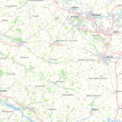
Le fond de plan est constitué à partir des données des contributeurs OSM et stylisé par Géo2France et Picardie Nature.
Metadata
- File identifier
- 3314f28f-2091-47c1-aca1-3cf551169977 XML
- Metadata language
- Français
- Character set
- UTF8
- Hierarchy level
- Dataset
- Hierarchy level name
-
Précision sur le niveau de hiérarchie (non INSPIRE)
- Date stamp
- 2024-09-30T08:09:30.327094Z
- Metadata standard name
-
ISO 19115:2003/19139
- Metadata standard version
-
1.0
- Metadata author
-
Organisation name Individual name Electronic mail address Role Géo2France
Point of contact
Overviews
Spatial extent
Provided by
