PCRS Raster Régional - Orthophoto 5 cm
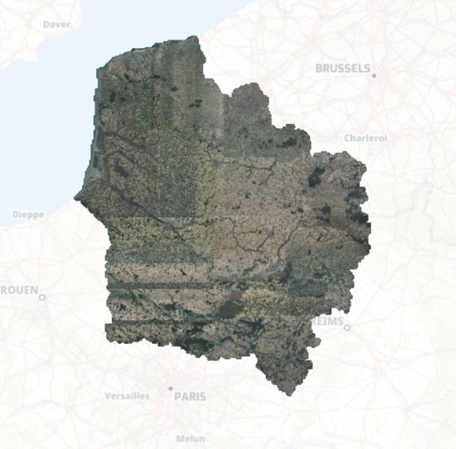
Orthophotographie numérique couleur du territoire de la Région Hauts-de-France en 2021, 2022 et 2023, pixel 5 cm. Projet de PCRS (Plan de Corps de Rue Simplifié) porté par Géo2France, en partenariat avec l'IGN, et des financements européens. ALes 32 000 km² de la région sont disponibles en flux WMS et en téléchargement (mosaïque au format COG ou livraison par dalle de 1 x 1 km ).
default-legacy
- Date (Creation)
- 2022-12-01
- Citation identifier
- https://www.geo2france.fr/ortho/2021/pcrs
- Point of contact
-
Organisation name Individual name Electronic mail address Role Géo2France
Géo2France
Point of contact
-
GEMET - INSPIRE themes, version 1.0
-
-
Ortho-imagerie
-
-
Région
-
-
HAUTS-DE-FRANCE
-
pcrs
-
PCRS
-
-
Départements
-
-
SOMME
-
PAS-DE-CALAIS
-
NORD
-
OISE
-
AISNE
-
- Theme
-
-
DONNEES OUVERTES
-
ORTHO
-
ORTHOPHOTO
-
PCRS
-
RTGE
-
- Access constraints
- Other restrictions
- Other constraints
- Pas de restriction d’accès public
- Use constraints
- Other restrictions
- Other constraints
-
Licence Ouverte version 2.0 https://www.etalab.gouv.fr/wp-content/uploads/2017/04/ETALAB-Licence-Ouverte-v2.0.pdf
- Spatial representation type
- Grid
- Distance
- 5 cm
- Denominator
- 200
- Language
-
fre
- Character set
- UTF8
- Topic category
-
- Imagery base maps earth cover
- Description
-
France
- Description
-
HAUTS-DE-FRANCE
))
- OnLine resource
-
Protocol Linkage Name OGC:WMS https://www.geo2france.fr/geoserver/geo2france/ows assemblage_pcrs_raster_regional_hauts_de_france
WWW:LINK-1.0-http--link
https://www.geo2france.fr/mviewer/?config=apps/pcrs.xml# Visionneuse cartographique
- Hierarchy level
- Dataset
Conformance result
- Date (Publication)
- 2000-01-01
- Explanation
-
-- Information sur l'évaluation de la conformité (non INSPIRE) --
- Pass
- Statement
-
Les prises de vues, l’aérotriangulation et la production de l'ortho ont été réalisées par des sous-traitant de l’IGN dans le cadre du partenariat Géo2France-IGN pour la réalisation du PCRS Raster Régional.
Metadata
- File identifier
- 94a69703-572f-463a-9cfc-6bca075384b8 XML
- Metadata language
- Français
- Character set
- UTF8
- Hierarchy level
- Dataset
- Hierarchy level name
-
Précision sur le niveau de hiérarchie (non INSPIRE)
- Date stamp
- 2024-05-24T16:03:28.022931Z
- Metadata standard name
-
ISO 19115:2003/19139
- Metadata standard version
-
1.0
- Metadata author
-
Organisation name Individual name Electronic mail address Role Géo2France
Géo2France
Point of contact
Overviews
Spatial extent
Provided by
